WASHINGTON COUNTY HISTORICAL SOCIETY (Washington County, Utah)
WASHINGTON COUNTY HISTORICAL SOCIETY PHOTO COLLECTION
Photo WCHS-03512
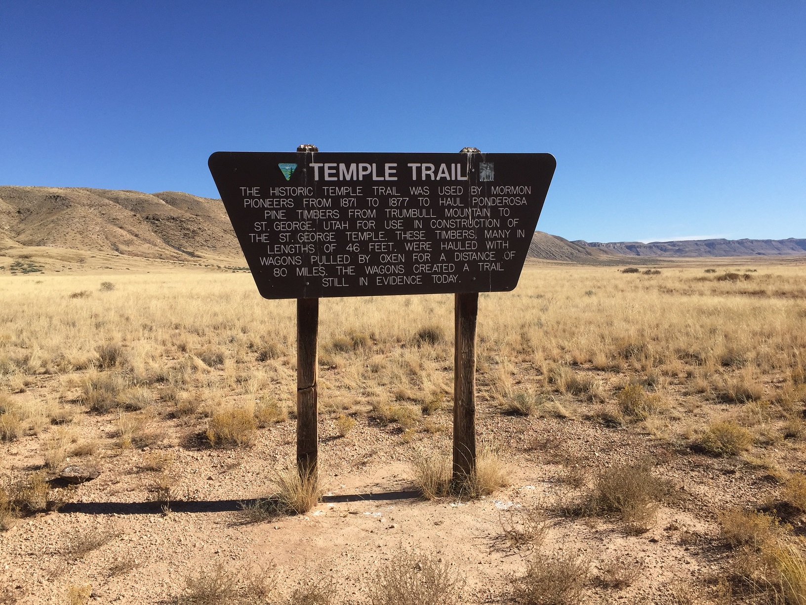
Photo of the big Temple Trail sign where the Temple Trail crosses Mohave County Road 30 (Navajo Trail).
Also see WCHS-2365 and WCHS-03524.
Photo taken by George Cannon at 3:15 pm MDT on 10/27/2017 while on a Cotton Mission Chapter Sons of
Utah Pioneers field trip to explore the Temple Trail on the Arizona Strip and contributed by him on 11/5/2017.
The camera is facing southeast and was located at
36° 44' 44.87" North Latitude; 113° 17' 59.08" West Longitude.