WASHINGTON COUNTY HISTORICAL SOCIETY (Washington County, Utah)
WASHINGTON COUNTY HISTORICAL SOCIETY PHOTO COLLECTION
Photo WCHS-02648
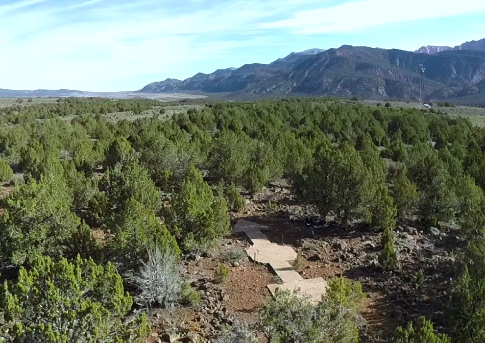
Aerial photo of the Black Ridge cement aviation navigation arrow.
For a higher resolution version of this photo, click here.
The camera is facing northnortheast.
On the right side of the photo is the cell tower at the top of the Black Ridge.
Photo taken by Roger Simister in early 2015 using a quad copter and contributed by him on 7/20/2015.