WASHINGTON COUNTY HISTORICAL SOCIETY (Washington County, Utah)
FORT PEARCE
Warner Valley, Utah
LOCATION
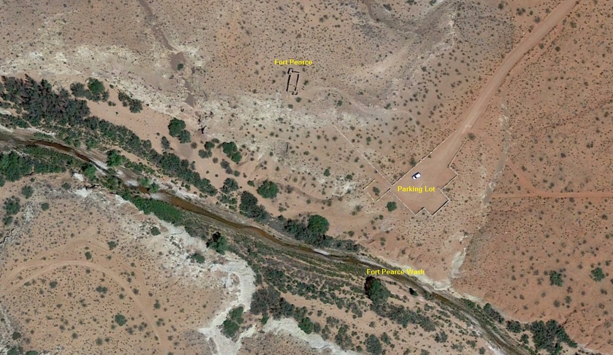
Located on the Warner Valley Gap Road about twelve miles southeast of St. George.37° 0' 28.2" North Latitude, 113° 24' 42.5" West Longitude
37.0078° North Latitude, 113.4118° West Longitude
2,967 feet (904 meters) MSL
HISTORY
Fort Pearce was built and occupied by Mormon settlers desirous of maintaining agricultural communities in that part of southern Utah. Although the direct purpose in building the fort was to keep Navajos from raiding settlements, its corral proved to be its most useful asset, in keeping livestock from destroying valuable crops.Fort Pearce was built during the Blackhawk War of 1865-1868, a period of conflict with the Ute Indians in central and southern Utah. This was Utah's last major Indian conflict. During this time the Navajo Indians also raided the settlements of southern Utah. The Navajos used Fort Pearce Wash as a means of gaining entry into these Mormon settlements. The fort was built in 1866 to keep out the Navajo raiding parties. No battle was ever fought with the Indians at the site.
Also during this period the farmers fields were not fenced and the fort with its large corral was used to hold cattle to keep them from destroying the crops in the fields. This holding of cattle at Fort Pearce was a common practice and continued long after the Indian unrest ceased.
The fort and the wash upon which it is situated is named for Captain John D. L. Pearce, noted military leader and Indian fighter from St. George, Utah, who took part in the Black Hawk War and other Indian conflicts in southern Utah.
At the present time, the area is visited by the local people, scouting groups and historical societies as a means of conveying an awareness and interest in the pioneer heritage of this part of southern Utah.
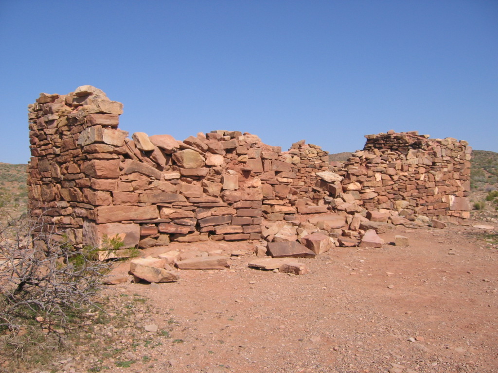
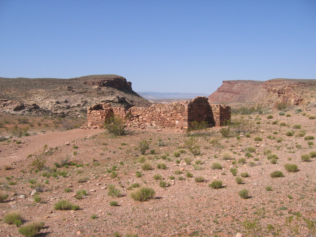
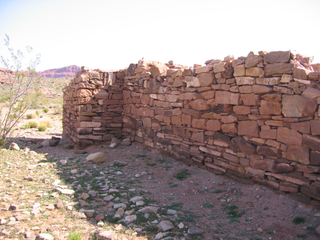
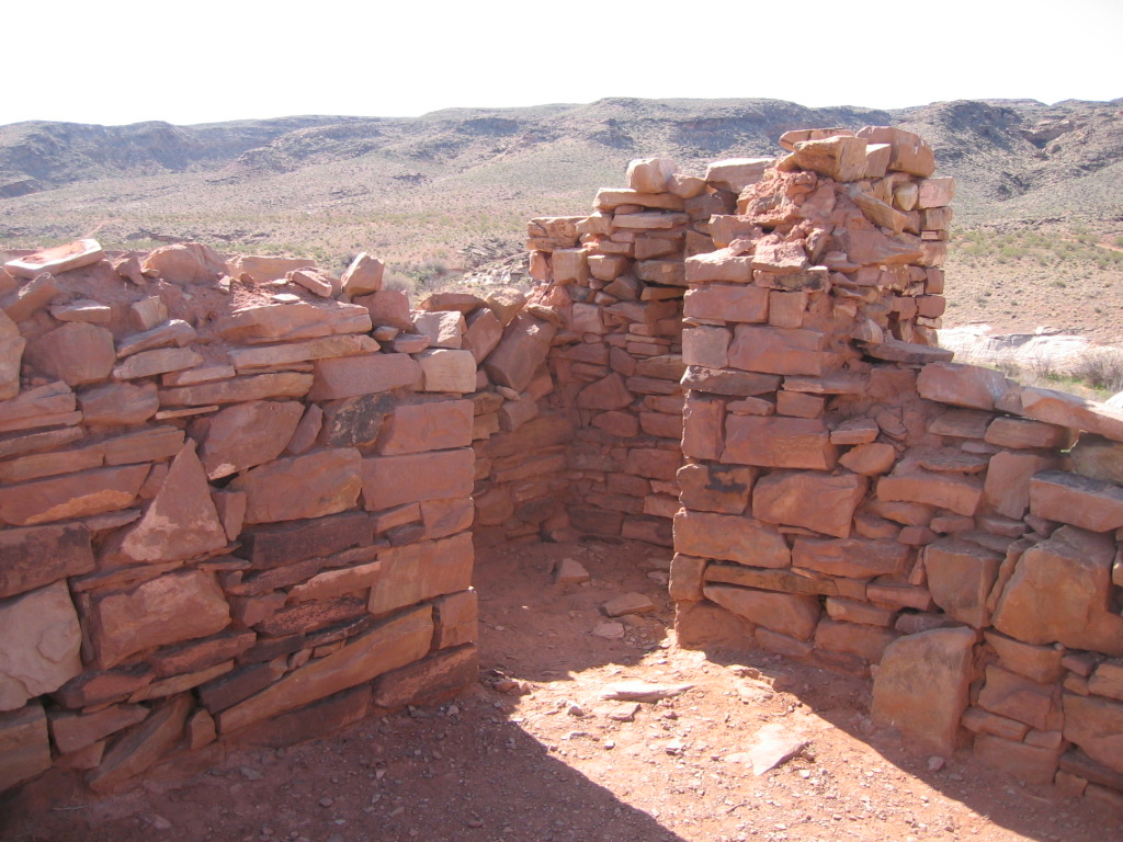
Fort Pearce, situated on the edge of Fort Pearce Wash, is a rock-walled structure that at present has walls standing approximately six feet high. The single story structure is over thirty feet long and the gunports are now a part of the irregular outline of the top of the walls. There are also the remains of a rock corral a short distance to the south of the fort. The walls of this corral are only a few feet high at one corner and usually consist of piles of rock rubble. Much of the corral's walls has eroded away due to its location in the wash. The fort itself is situated on exposed rock and is not in danger from soil erosion.
In the book, Immortal Pioneers, Albert E. Miller states that originally the walls of the fort were about eight feet high. The structure was never roofed. This fort was fashioned in the shape of a cross with two portholes in the front of each of the four projecting ends, and one porthole in each side of each projection, making in all sixteen portholes. This arrangement gave the guards a crossfire from all directions. From looking at the present outline of the fort, it is doubtful whether the fort actually was in the shape of a cross as stated above.
Building of the fort started on December 4, 1866, as noted in the diary of Charles L. Walker of Washington, Utah. In 1869, the Washington Ward Tithing Ledger indicated that at least six men were given credit for work done on the repair of the fort and the building of corral. It is also noted in the diary of Charles L. Walker that he and other men of the area did repair work on the fort and built a corral in late 1869.
In Red Hills of November, A. K. Larson states that four days of hard labor (December 20-24, 1869) by nineteen men produced a corral with walls five and one-half feet high on a base two and one-half feet wide. This corral is just south of the fort and appears to have crossed the wash and included ground on both sides.
Put on the National Register of Historic Places (#1975001834) on November 20, 1975.
PHOTOS
 WCHS-00048 Fort Pearce on Hill Above Fort Pearce Wash |
 WCHS-00057 Back Wall of Fort Pearce |
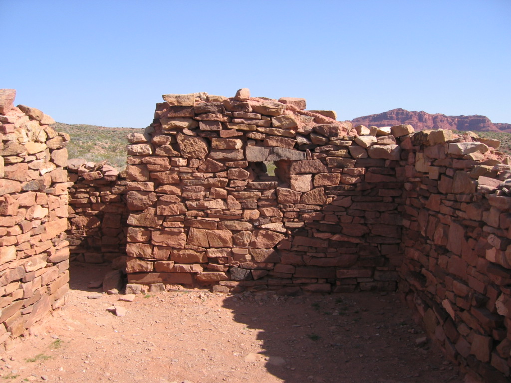 WCHS-00059 End of the Main Room at Fort Pearce |
 WCHS-00064 Corner Gunports at Fort Pearce |
Other WCHS photos:
WCHS-00035 Photo of the "Floor Plan - Fort Pearce" sign on the edge of the parking lot
WCHS-00036 Photo of the "Construction - Fort Pearce" sign on the edge of the parking lot
WCHS-00037 Photo of the "The Wall at Fort Pearce" sign on the edge of the parking lot
WCHS-00038 Photo of the "Fort Pearce Wash" sign on the edge of the parking lot
WCHS-00039 Photo of the parking lot below Fort Pearce
WCHS-00040 Photo of Bart Anderson speaking to a group at Fort Pearce
WCHS-00041 Photo of Bart Anderson speaking to a group at Fort Pearce
WCHS-00042 Photo of Fort Pearce as seen from the parking lot
WCHS-00043 Photo of Fort Pearce as seen from the parking lot
WCHS-00044 Photo of Fort Pearce
WCHS-00045 Photo of Fort Pearce
WCHS-00046 Photo of the front of Fort Pearce
WCHS-00047 Photo of the south and east faces of Fort Pearce
WCHS-00049 Photo of east and north faces of Fort Pearce
WCHS-00050 Photo of the northwest corner of Fort Pearce
WCHS-00051 Photo of the northwest corner of Fort Pearce
WCHS-00052 Photo of the south and east sides of Fort Pearce
WCHS-00053 Photo of the south and east sides of Fort Pearce
WCHS-00054 Photo of the gunport on the south face of Fort Pearce
WCHS-00055 Photo of south face of Fort Pearce
WCHS-00056 Photo of the southwest corner of Fort Pearce
WCHS-00058 Photo of the north and east sides of Fort Pearce
WCHS-00060 Photo of the gun port on the north wall of Fort Pearce
WCHS-00061 Photo of the inside northwest corner of Fort Pearce
WCHS-00062 Photo of the inside southwest corner of Fort Pearce
WCHS-00063 Photo of the inside southeast corner of Fort Pearce
WCHS-00065 Photo of the Fort Pearce wash
WCHS-00066 Photo of the trail along the Fort Pearce Wash on the south side of Fort Pearce
WCHS-00067 Photo of the remnant of the rock wall at Fort Pearce
WCHS-00068 Photo of river running through the Fort Pearce Wash just south of the fort
WCHS-00069 Photo of some petroglyphs a little west of Fort Pearce
WCHS-00070 Photo of some petroglyphs a little west of Fort Pearce
Other photos on the web:
Photo of Fort Pearce
Photo of Fort Pearce
Photo of some walls at Fort Pearce and the wash behind
Photo of some of the Fort Pearce ruins
Photo of some of the rocks at Fort Pearce
Photo of the wash going west from Fort Pearce
Photo of the "Fort Pearce Historic Site" interpretive sign
Photos from the National Register of Historic Places nomination form
REFERENCES
Fort Pearce Map & InformationDixie Mission Chapter of the Sons of Utah Pioneers
Prepared by Scott Prisbry, Assistant Historian
5/4/1957, Revised 6/24/2974 and 9/7/1989
Description of the BLM's public use site: Fort Pearce Historic Site (1866-1873)
A history of Fort Pearce
National Register of Historic Places, Inventory - Nomination Form
A. K. Larson, "The Red Hills of November".
Pages 140, 173, 177.
A. K. Larson, "I Was Galled to Dixie".
Page 478.
Albert E. Miller, "Immortal Pioneers".
Pages 158, 195.
Washington County Chapter, Daughters of the Utah Pioneers, " Under Dixie Sun".
1950 with 1978 Supplement.
Page 249.
Southern Utah Memories: Fort Pearce: a reminder of Native American and Pioneer relations,
by Loren R. Webb, July 5, 2013