
WASHINGTON COUNTY HISTORICAL SOCIETY (Washington County, Utah)
UNIDENTIFIED RANCH ON THE ARIZONA STRIP
Arizona Strip, Arizona
LOCATION
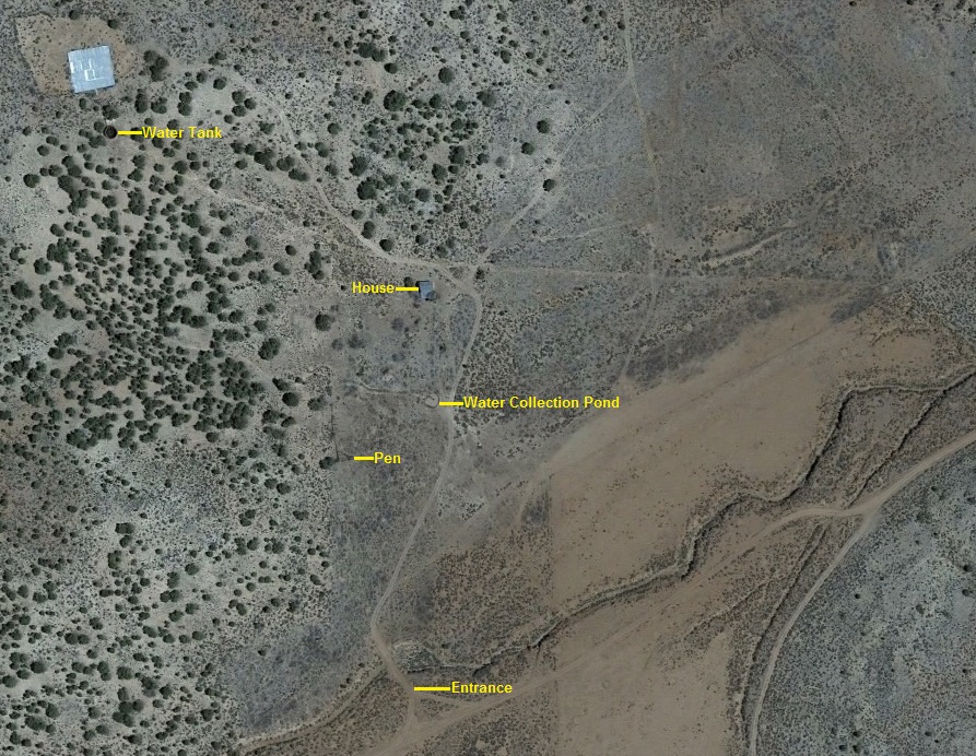
36° 32' 20.41" North 113° 12' 11.62" West, 5795' MSL, Water tank on the hill
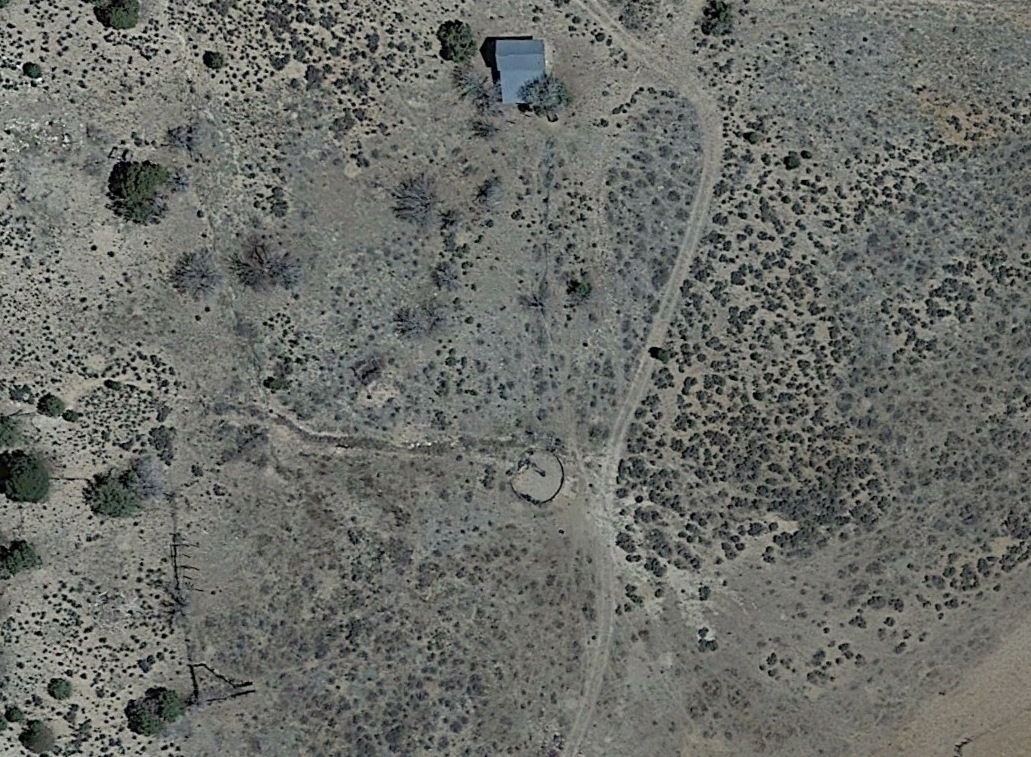
36° 32' 14.45" North 113° 12' 4.22" West, 5712' MSL, Ranch house
36° 32' 15.25" North 113° 12' 4.12" West, 5691' MSL, Water collection pond
36° 32' 14.09" North 113° 12' 6.37" West, 5703' MSL, Pen or corral
36° 32' 9.28" North 113° 12' 4.64" West, 5678' MSL, Entrance
DESCRIPTION
TBDHISTORY
TBDPHOTOS
 WCHS-02371 Looking northeast |
 WCHS-02374 Looking southwest |
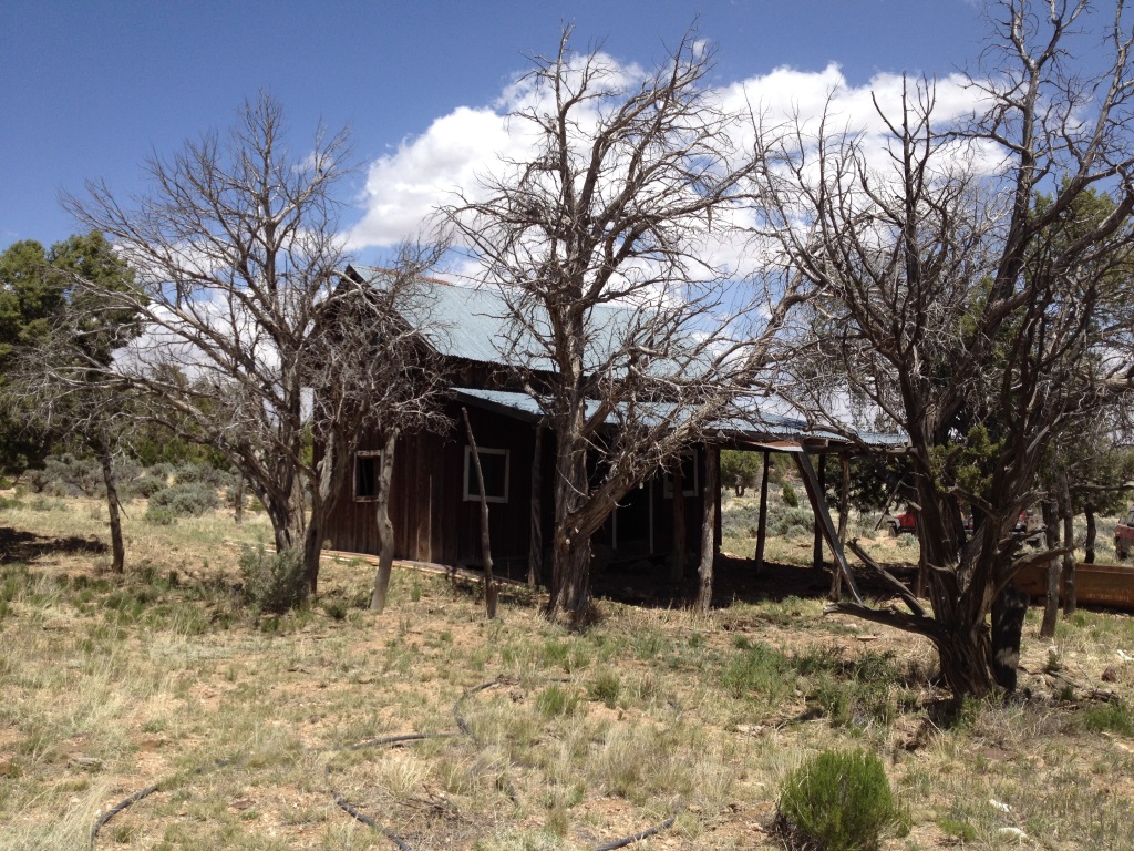
WCHS-02366 The east side of the old farmhouse
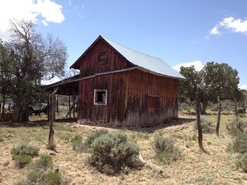
WCHS-02367 The southeast corner and front of the old farmhouse
WCHS-02368 A watering trough in front of the old farmhouse
WCHS-02369 The front of the old farmhouse
WCHS-02370 The front of the old farmhouse
WCHS-02372 The west side of the old farmhouse
WCHS-02373 The back and west sides of the old farmhouse
WCHS-02375 The inside of the old farmhouse (through the east window)
WCHS-02376 The water collection pond on the ranch